
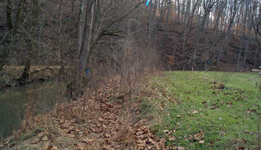
Beaver Creek Watershed: Streambank Stabilization
Mill Run Neighborhood streambank repair & tree planting

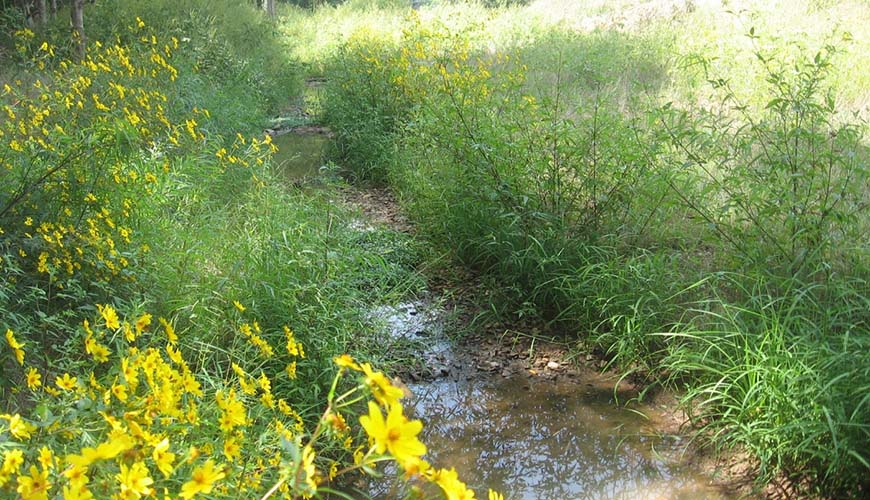
Stock Creek Watershed: Rain Garden
South Doyle High School
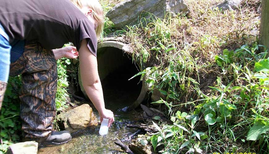
Stock Creek Watershed: Water Quality Sampling
DNA-source tracking analysis
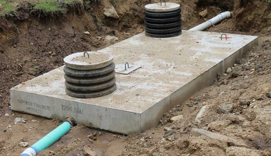
Stock Creek Watershed: Septic System Repair
Grant funds periodically available for system repairs
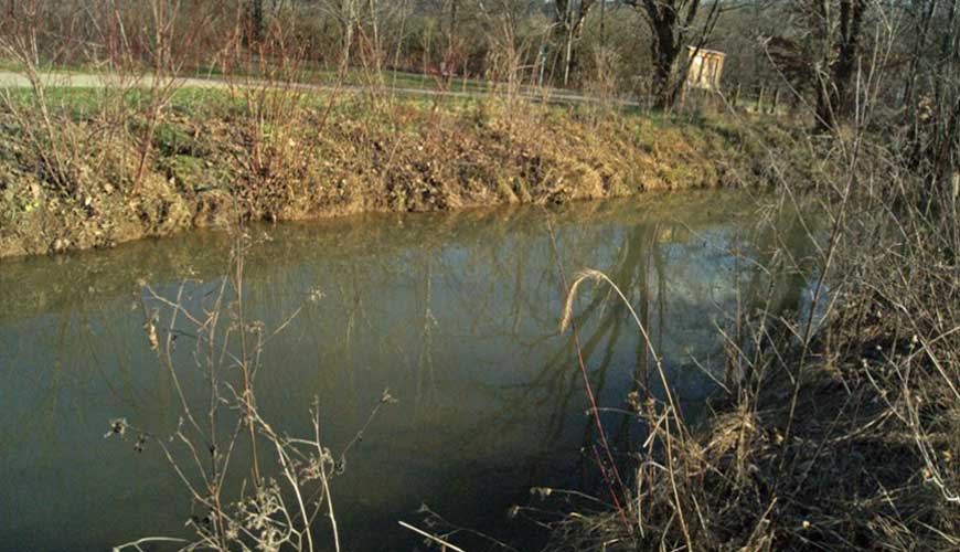
Beaver Creek Watershed: Streambank Stabilization
Halls Community Park Habitat & Stream Restoration
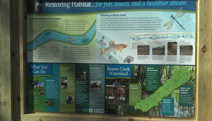
Beaver Creek Watershed: Park Restoration
Halls Community Park Habitat Restoration
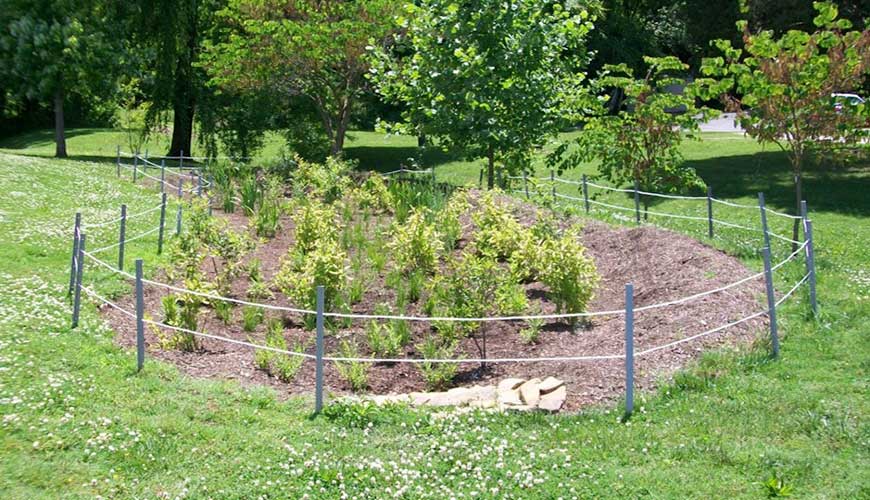
Beaver Creek Watershed: Rain Garden Installation
Powell Station Park
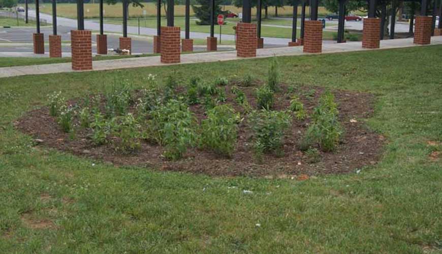
Beaver Creek Watershed: Rain Garden Installation
Powell Middle School
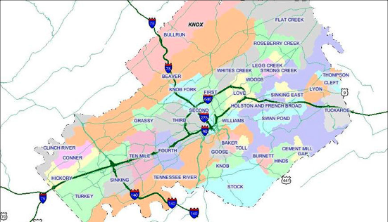
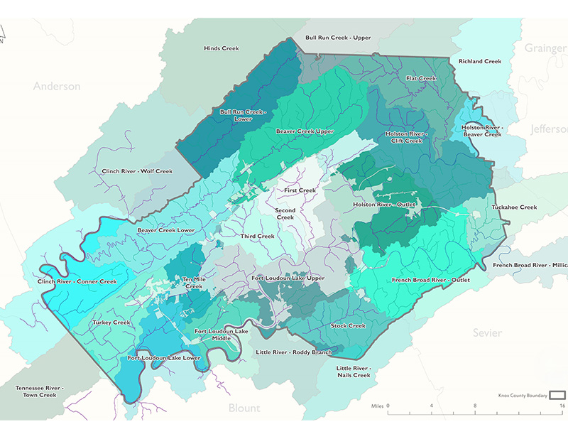
What is a Watershed?
A watershed is an area of land that drains to a common body of water, like a stream, river, or lake. Larger waterbodies often have many smaller watersheds that drain to them. Healthy watersheds provide clean water for drinking, irrigation, and industry, and food and shelter for wildlife. However, watersheds can be greatly affected by human impacts because pollutants can become more and more concentrated as stormwater flows into waterbodies downstream.
Discover more about pollution prevention and how you can help improve our watersheds.
Everyone lives in a watershed! Find your watershed by visiting the KGIS Watershed Map and entering your address in the search box at the top.
Watershed Planning & Initiatives
Watershed planning helps address water quality problems in a holistic manner by fully assessing the potential contributing causes and sources of pollution, then prioritizing restoration and protection strategies to address these problems.
Knox County employs a variety of methods to address watershed health. In rural watersheds, this may include repairing failing septic systems or improving agricultural practices, and in more developed watersheds the focus may be on retrofitting existing stormwater infrastructure or restoring urban streams. Knox County also conducts a wide variety of education and outreach activities to help spread the word about impairments to our watersheds and actions we can take.
- Find out if you qualify for Agricultural Best Management Practices.
- Learn about the process for applying for grant cost-share funding.
- Explore Knox County’s education and participation opportunities.
Knox County Stormwater Compliance also participates in a host of watershed initiatives formed by various governmental agency, private business, and/or non-profit organization partnerships. For more information on those initiatives see the watershed initiatives below.
CURRENT INITIATIVES
Integrated Watershed Planning
Knox County is in the process of developing an Integrated Watershed Plan to holistically address water quality and quantity challenges across the region. This comprehensive initiative aims to assess watershed health, identify improvement projects, and establish a consistent framework for sustainable water management. Updates and opportunities to participate in this initiative will be posted on the Integrated Watershed Plan page.
Turkey Creek Watershed Initiative
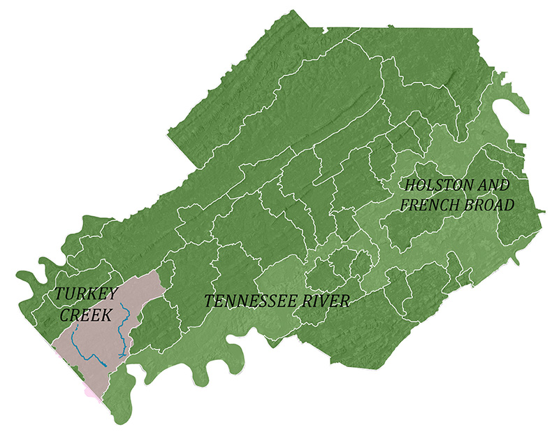
Turkey Creek is on Tennessee’s 303(d) list of impaired streams for sedimentation and high bacteria levels. According to the Tennessee Department of Environment and Conservation, the primary cause of the impairment in the Turkey Creek Watershed is its location in a high-density urbanized area, where sediment and bacteria can easily wash into waterways. The watershed is located primarily within the bounds of Knox County, the Town of Farragut, and City of Knoxville, so the municipalities partnered to create a watershed plan to restore the watershed and address these impairments.
On July 1st, 2024, Knox County, the Town of Farragut, and the City of Knoxville were awarded a $205,000 grant by the TN Department of Agriculture to improve water quality in the Turkey Creek Watershed.
The grant will provide up to 75% cost-share funds to homeowners and commercial property owners to support green infrastructure projects to solve water quality problems in the watershed, including:
- Detention pond retrofits in commercial and residential areas
- Septic system repairs (focused on the North Fork Turkey Creek area)
- Residential rain garden installations
- Grassy swales/vegetative filter strips/porous pavement installations to replace concrete drainageways
- Streambank stabilization and stream buffer planting.
In addition to these projects, the grant will support several community outreach and education efforts, including:
- Targeted mailing to inform the public of opportunities to participate
- Educational visits to classrooms and community groups
- Stream/wetland clean-up volunteer opportunities
- “Make-it, take-it” rain barrel workshops and rain barrel sales
- Pet waste disposal stations installed in high-use areas
If you live or work in the Turkey Creek Watershed and have an idea for a project, wish to request an educational program, or want to learn more about this initiative, please contact Knox County Engineering & Public Works at 865-215-5800.
You can view the Turkey Creek Watershed Based Plan created with the support of the University of Tennessee S’22 Watershed Planning and Management class here:
Bluegrass Lake Watershed Initiative
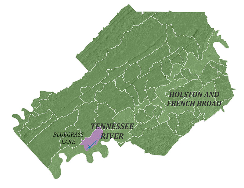
Bluegrass Lake is located adjacent to a section of the Tennessee River impounded by the Fort Loudoun Dam, in Knox County southwest of downtown Knoxville, TN. Sinking Creek, that drains into the lake, is on Tennessee’s 303(d) list of impaired streams for high bacteria levels, and recent data suggests it may be listed for sedimentation in the future. According to the Tennessee Department of Environment and Conservation, the primary cause of the impairment in the Turkey Creek Watershed is its location in a high-density urbanized area, where sediment and bacteria can easily wash into waterways.
Knox County EPW has recently applied for project funding in this watershed and will update this page when more information is available.
PAST INITIATIVES
Beaver Creek
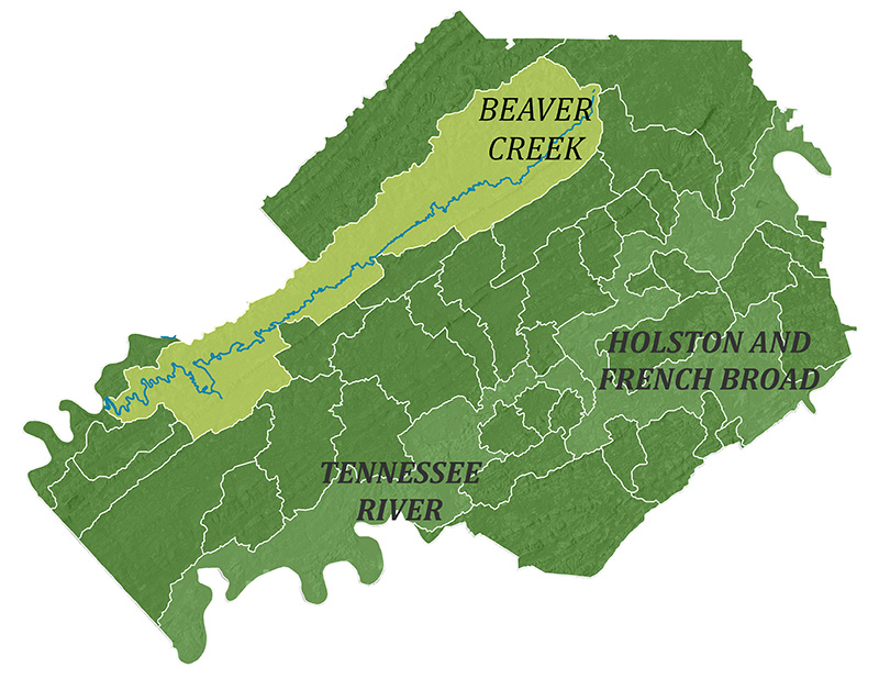
Knox County is home to the Beaver Creek watershed, a rapidly urbanizing 86 square-mile watershed located entirely in northern Knox County, within the 630 square mile Lower Clinch Basin. The 44 miles of main stem of Beaver Creek plus seven main tributaries wind through five different communities before emptying into the Clinch River. Beaver Creek is a rapidly urbanizing watershed with approximately 80,000 residents. Two communities in the watershed, Gibbs and Karns, have been identified by the Metropolitan Planning Commission as the fastest growing areas in Knox County.
Beaver Creek is heavily impaired due to this rapid population growth and has been the focus of a partnership of several government agencies, non-profit organizations and private businesses dedicated to addressing the impacts to Beaver Creek, since 1998. The primary impacts to the creek include sediment, nutrients and pathogens from agricultural and urban runoff, nutrients and pathogens from municipal point sources, and habitat alteration due primarily to land development.
In 2021, Knox County was awarded a $115,100 clean water grant from the TN Department of Agriculture to help pay the costs of fixing failed septic systems and putting improvements on farm properties. This grant targeted a 26-square-mile focus area in the Upper Beaver Creek Watershed and ran through July 2024.
Explore the detailed history of the Beaver Creek Task force and its achievements in improving water quality in the watershed and view the Beaver Creek Watershed restoration plan below:
Flat Creek
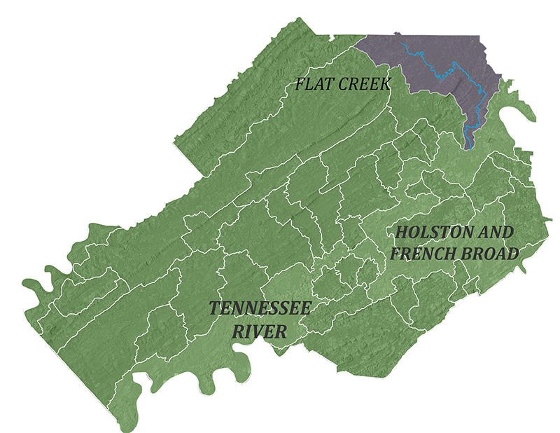
No matter where you go in the Flat Creek Watershed in Northeast Knox County, you can see House Mountain. The 500-acre House Mountain State Park with its 2,100-foot peak is the most recognizable feature in East Knox County. Flat Creek rounds the mountain on its northeast side. The 68-square-mile Flat Creek Watershed originates in Grainger County and crosses the southern portion of Union County before entering Knox County and ending at the Holston River. About 40% of the watershed is in Knox County.
The Knox County Soil Conservation District received a grant from the Tennessee Department of Agriculture for implementation of ag best management practice projects and repairs of failing septic systems. This grant ran from February 2021-July 2024.
Explore the detailed history of the Flat Creek Watershed and view the Flat Creek Watershed restoration plan below:
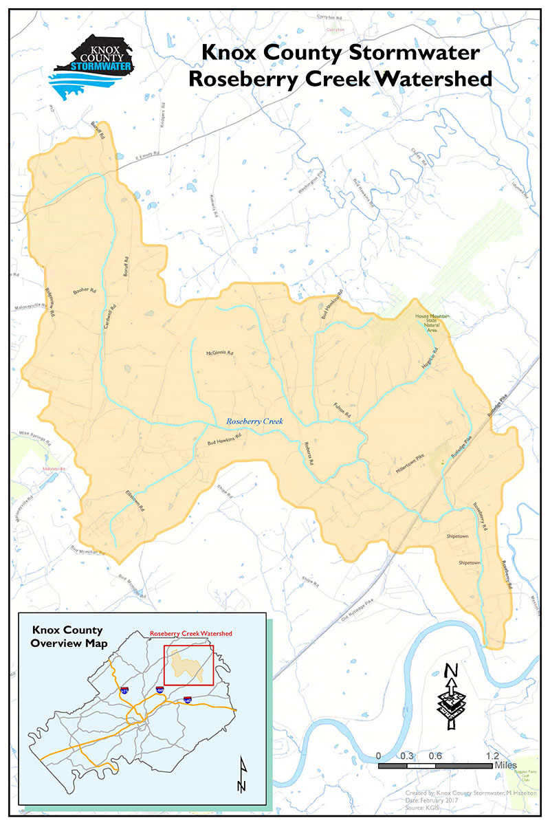
Roseberry Creek
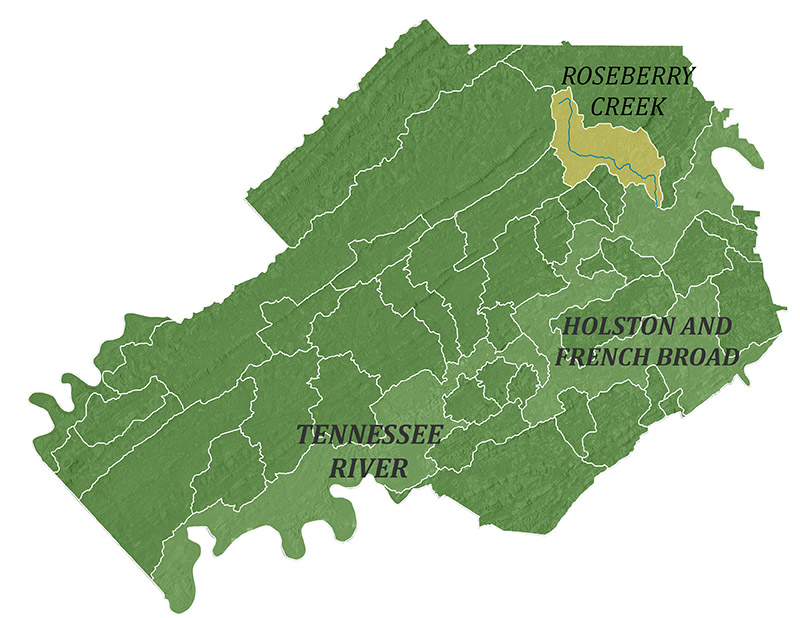
The 13-square-mile Roseberry Creek Watershed is nestled between the Beaver Creek and Flat Creek Watersheds in northeast Knox County. Roseberry Creek originates in the Corryton Community and winds its way through 19.92 miles of pasture and pockets of rural residential land to its confluence with the Holston River.
Roseberry Creek is listed as impaired for E. coli by the Tennessee Department of Environment and Conservation (TDEC). This means that the bacteria E. coli is above levels considered safe for human contact. Exposure to high levels of this bacteria may cause illness. TDEC has determined that the elevated E. coli levels result from failing septic systems and poor pasture on agricultural land. Runoff from these sources carry the bacteria to the creek. KUB has limited sewer service in this watershed. This means that the majority of dwellings are on septic systems.
The Tennessee Department of Agriculture awarded Knox County $144,000 from its 319(h) clean water grant program to help pay the costs of fixing homeowners’ failed septic systems and putting improvements on farm properties. This grant ran from March of 2017 – March 2019.
Explore the detailed history of the Roseberry Creek Watershed and view the Roseberry Creek Watershed restoration plan below:
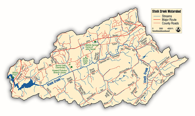
Stock Creek
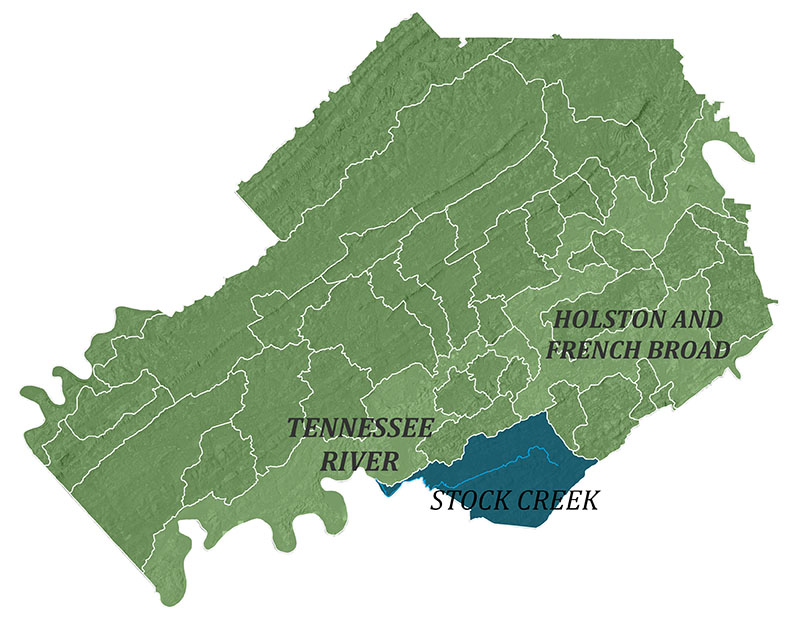
The 21 square mile Stock Creek Watershed is located in the southern part of Knox County. With almost two-thirds in rolling pasture or covered in forest, the Stock Creek Watershed retains a largely rural character. The watershed is home to Marble Springs, South Doyle High School, and French Memorial Park. Stock Creek originates behind Walmart on Chapman Highway and winds its way through forested ridges and pasture with pockets of rural residential land to its confluence with the Little River.
Stock Creek is listed as impaired for E. coli by the Tennessee Department of Environment and Conservation (TDEC). This means that the bacteria is above levels considered safe for human contact. Exposure to the water may cause illness. TDEC has determined that the elevated E.coli levels result from failing septic systems and poor pasture practices on agricultural lands. Runoff from these sources carry the bacteria to the creek. Knox-Chapman Utility District has limited sewer service in this watershed. This means that the majority of dwellings are on septic systems.
The Stock Creek Task Force (SCTF), a consortium of agencies, universities, and utilities that have come together to protect and improve Stock Creek, has been working together since 2001 to assess conditions, prioritize problems, educate residents, and implement solutions. As a part of the most recent task force initiative, Knox County Stormwater applied for and received a Tennessee Department of Agriculture clean water grant of $115,000 to help pay the costs of fixing failed septic systems and putting improvements on farm properties. This grant ran from March 2019 through July 2022.
Explore the detailed history of the Stock Creek Watershed and view the Stock Creek Watershed Restoration Plan below: